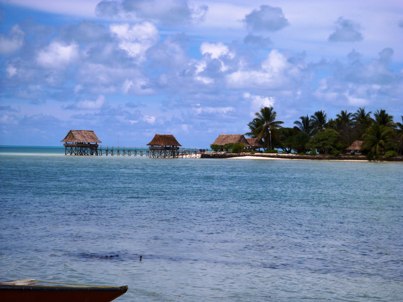
 Nevertheless my little point-and-shoot camera captured some of the most idyllic pictures you could ever dream of ...
 White sandy beaches, with palm trees licking up the equatorial sun, and clear Pacific blue water ...
  Native habitat made of local materials, traditional styles, and "home-spun" craftsmanship ...
 Children and adults alike swim and bath in the crystal clear waters of a huge lagoon situated on an ancient coral reef.
 Yet, Kiribati was the site of the bloodiest battle of World War II. And it has been trying to recover ever since. It is a "study" of the long-term cultural effects of government-style intervention with social programs.
Everywhere we went, everyone we spoke to, everything we saw, underscored the continuing need for more intervention, more foreign aid, or more social assistance programs. Yet, each look also revealed, with equally impressive evidence, a pattern of long term local neglect and abuse. Everywhere, we saw evidence of what used to be, or of what they once had; all of which was originally given as a free gift—a hand out—from some foriegn government or charitable organization. With sincere appreciation they willingly accept anything and everything someone is willing to give them, run it until it dies, then walk away and wait for someone else to either fix it or give them another one; never lifting a finger to help themselves, just patiently doing without until someone comes to their rescue.
So here I was combing the place, visiting with members of Parliament and other high ranking officials to try to determine what needs they had that we could assist with. Hmmm, and why would I want to do that? The answer: Because the LDS Church doesn’t offer just “free gifts” that perpetuate a “something-for-nothing” mentality, as you will see.
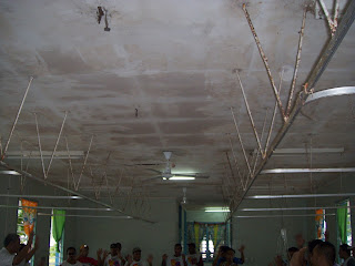
 You may recall some pictures in an earlier blog of the hospital here. In fact you may remember this picture of a nursing unit utility room.
 We've been working to get some projects organized that will help them now and in the long-term. Part of the purpose of this trip was to kick off a couple of these projects.
 We had more than eighty people from the community show up the first day of our service project; and a like number everyday thereafter. We provided all of the supplies and materials; but they had to provide all of the labor and supervision (volunteers).
 They worked twelve hours a day for six consecutive days to scrub, scrape, sand, and paint five hospital units (wards), inside and out.
Here are the before, during and after pictures of the medical ward.

 This next picture is an after shot of the same utility room shown above.
 It is our belief that by working for what they get, they will appreciate it more and will try a little bit harder to take care of it and keep it up -- and they will feel better about themselves. Hopefully, their improved self-esteem will spill over into other parts of their lives, and little by little they will begin to take responsibility for their own future.
Another of my purposes in going was to check out some clean water projects we have planned for several villages. These projects, too, will require the villagers to work for what they receive.
 This picture is of a meeting we had with the village leaders in one of the communities we will be placing a rain water harvesting system. The meeting was conducted in a big hut called a “Maneaba.”
Every village in Kiribati has a Maneaba. They can be as much as 40 meters long. They are used for community meetings, social gatherings, youth activities, etc.
 Even though it was very hot on the day we had our meeting, it was comfortable under the Maneaba. One of the men in the meeting gave us some coconuts to drink from. Mmmm, it was refreshing!
 One day we went in a small boat to some of the other islands. They are just called the “outer islands.” Some of them don’t have names, but we went to one that was called Abaiang.
 All went well until it started to storm. Then the sea got rough and we started to bounce around. So we had to slow down, and that took us a lot longer to get to Abaiang. I was really glad when we finally got there because I was starting to get a bit sea sick.


 Everywhere we went the people apologized for not being prepared to feed us – “next time let us know when you are coming and we will prepare a feast.”
Back in Tarawa, Kitibati I enjoyed one last sunset outside my apartment door before returning to my sweetheart in New Zealand.
 We had more than eighty people from the community show up the first day of our service project; and a like number everyday thereafter. We provided all of the supplies and materials; but they had to provide all of the labor and supervision (volunteers).
 They worked twelve hours a day for six consecutive days to scrub, scrape, sand, and paint five hospital units (wards), inside and out.
Here are the before, during and after pictures of the medical ward.


 This next picture is an after shot of the same utility room shown above.
 It is our belief that by working for what they get, they will appreciate it more and will try a little bit harder to take care of it and keep it up -- and they will feel better about themselves. Hopefully, their improved self-esteem will spill over into other parts of their lives, and little by little they will begin to take responsibility for their own future.
Another of my purposes in going was to check out some clean water projects we have planned for several villages. These projects, too, will require the villagers to work for what they receive.
 This picture is of a meeting we had with the village leaders in one of the communities we will be placing a rain water harvesting system. The meeting was conducted in a big hut called a “Maneaba.”
Every village in Kiribati has a Maneaba. They can be as much as 40 meters long. They are used for community meetings, social gatherings, youth activities, etc.
 Even though it was very hot on the day we had our meeting, it was comfortable under the Maneaba. One of the men in the meeting gave us some coconuts to drink from. Mmmm, it was refreshing!
 One day we went in a small boat to some of the other islands. They are just called the “outer islands.” Some of them don’t have names, but we went to one that was called Abaiang.
 All went well until it started to storm. Then the sea got rough and we started to bounce around. So we had to slow down, and that took us a lot longer to get to Abaiang. I was really glad when we finally got there because I was starting to get a bit sea sick.
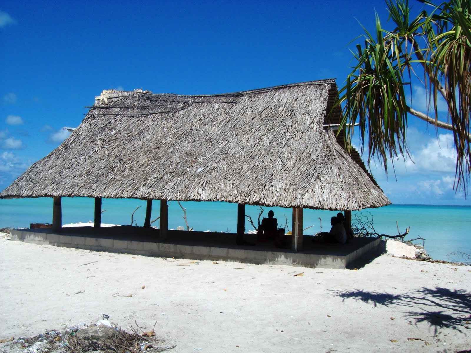
Almost all of the people live in houses that look like this one. The floor is built up off the ground, and the roof is made of thatched palm fronds. As in almost all of the islands, they sleep on mats that they weave from Pandanus leaves.

Some of the islands had a richer top soil which allowed grass to grow naturally. Others had the same sand and coral mix that was prevalent in Tarawa. None the less, we saw some very beautiful, well kept villages. I was most impressed with the outer islands.

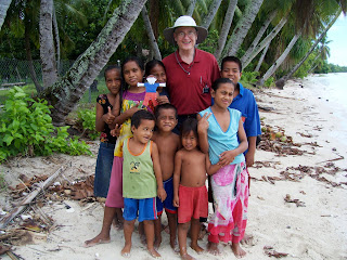
Anyone who really knows me, knows how much l love little children. So, naturally, every island we went to I was able to gather a small crowd of children. In this picture, the children are holding Flat Stanley, who came to visit us from Florida.

Each time we left one of the outer islands the children came to the beach to wave good-bye to us. They are always happy to have visitors. Everyone was so gracious.
 Everywhere we went the people apologized for not being prepared to feed us – “next time let us know when you are coming and we will prepare a feast.”
Back in Tarawa, Kitibati I enjoyed one last sunset outside my apartment door before returning to my sweetheart in New Zealand.


 We started off early in the morning, and by the time we found the trailhead, it was about 9 am. This is "The Pinnacle", elevation 759 metres (2,490 feet), according to the map. So up we started.


